
File:Map of the partition of the Kingdom of Poland and the Grand Duchy of Lithuania from 1799.jpg

Size of this preview: 669 × 600 pixels. Other resolutions: 268 × 240 pixels | 535 × 480 pixels | 856 × 768 pixels | 1,142 × 1,024 pixels | 2,284 × 2,048 pixels | 6,330 × 5,677 pixels.
Original file (6,330 × 5,677 pixels, file size: 6.83 MB, MIME type: image/jpeg)
| This is a file from the Wikimedia Commons. Information from its description page there is shown below. Commons is a freely licensed media file repository. You can help. |
Summary
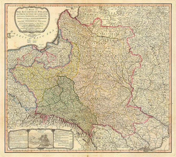
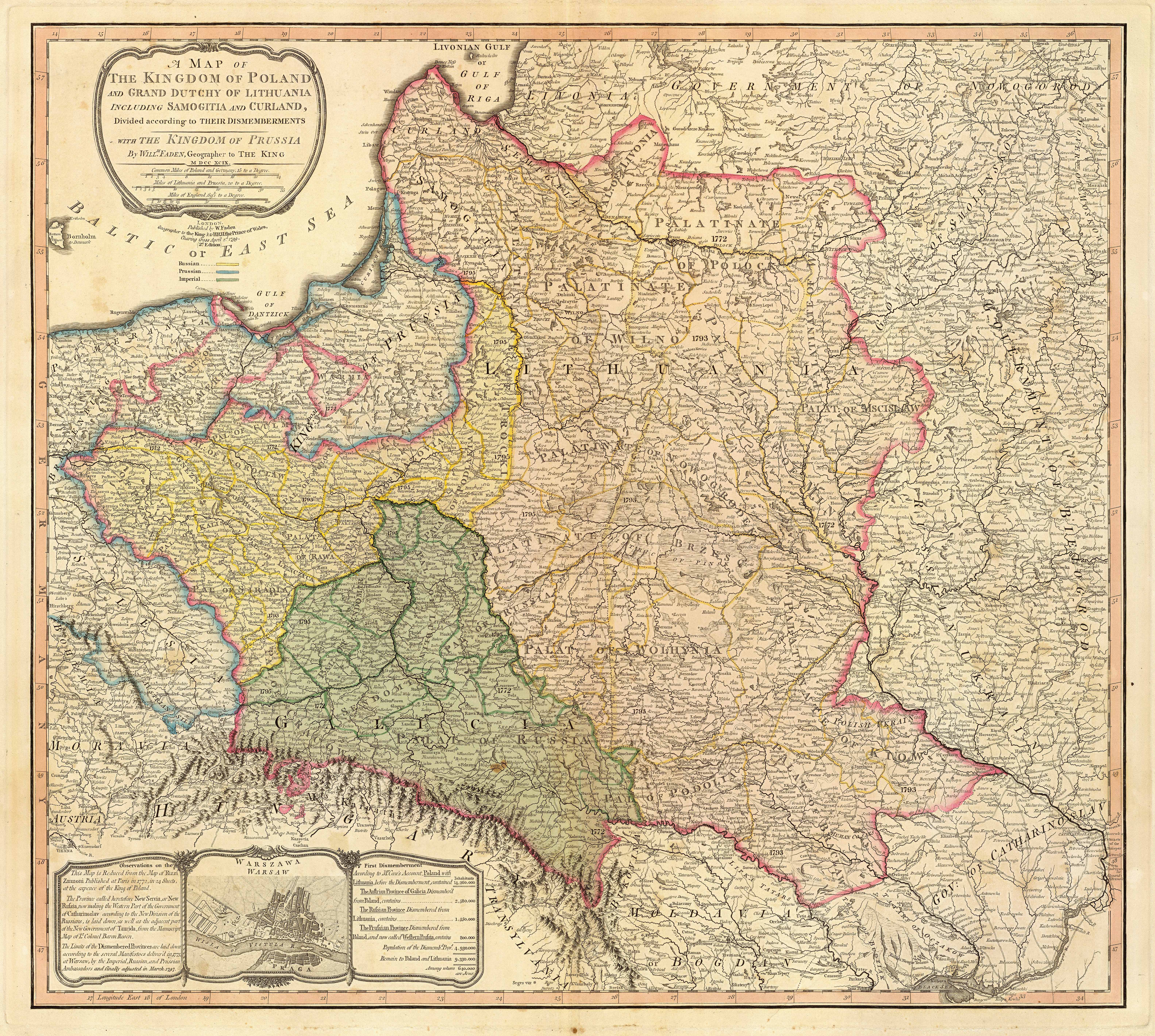
| Description | Title: "A map of the Kingdom of Poland and the Grand Duchy of Lithuania including Samogitia and Curland divided according to their dismemberments with the Kingdom of Prussia". A map from 1799 showing how the Polish-Lithuanian Commonwealth was partitioned in 1765-1795 between Prussia, Austria, and Russia. This is an extremely detailed map which lists all the cities and small towns and labels the regions according to their English names. The boundaries former Polish-Lithuanian Commonwealth colored light red. The areas taken by Prussia are colored yellow, those taken by Austria colored green, and those taken by Russia are colored beige. Prussia itself is bordered in blue. Eastern Pomerania and Warmia are shown as part of Prussia but bordered in red as well. | ||||||||||||||||||||||
| Date | |||||||||||||||||||||||
| Source | http://www.belarusguide.com/images/maps/Kokosha/POlonia&Lituania-1799.jpg | ||||||||||||||||||||||
| Author |
|
||||||||||||||||||||||
Licensing
|
This work is in the public domain in its country of origin and other countries and areas where the copyright term is the author's life plus 100 years or fewer. | |
| This file has been identified as being free of known restrictions under copyright law, including all related and neighboring rights. | |
File history
Click on a date/time to view the file as it appeared at that time.
| Date/Time | Thumbnail | Dimensions | User | Comment | |
|---|---|---|---|---|---|
| current | 05:04, 23 September 2007 | | 6,330 × 5,677 (6.83 MB) | Archaeogenetics | {{Information |Description=Title: "A map of the Kingdom of Poland and the Grand Duchy of Lithuania including Samogitia and Curland divided according to their dismemberments with the Kingdom of Prussia". A map from 1799 showing how the Polish-Lithuanian Co |
File usage
The following pages on the English Wikipedia use this file (pages on other projects are not listed):
Global file usage
The following other wikis use this file:
- Usage on et.wikipedia.org
- Usage on lt.wikipedia.org
- Usage on lt.wikibooks.org
- Usage on pnb.wikipedia.org
- Usage on th.wikipedia.org
- Usage on uk.wikipedia.org
- Usage on ur.wikipedia.org
- Usage on zh.wikipedia.org