Portal:Hawaii
The Hawaii Portal Hawaii (/həˈwaɪ.i/ hə-WY-ee; Hawaiian: Hawaiʻi [həˈvɐjʔi, həˈwɐjʔi]) is an island state of the United States, in the Pacific Ocean about 2,000 miles (3,200 km) southwest of the U.S. mainland. It is the only state not on the North American mainland, the only state that is an archipelago, and the only state in the tropics. Hawaii consists of 137 volcanic islands that comprise almost the entire Hawaiian archipelago (the exception, which is outside the state, is Midway Atoll). Spanning 1,500 miles (2,400 km), the state is physiographically and ethnologically part of the Polynesian subregion of Oceania. Hawaii's ocean coastline is consequently the fourth-longest in the U.S., at about 750 miles (1,210 km). The eight main islands, from northwest to southeast, are Niʻihau, Kauaʻi, Oʻahu, Molokaʻi, Lānaʻi, Kahoʻolawe, Maui, and Hawaiʻi, after which the state is named; the latter is often called the "Big Island" or "Hawaii Island" to avoid confusion with the state or archipelago. The uninhabited Northwestern Hawaiian Islands make up most of the Papahānaumokuākea Marine National Monument, the largest protected area in the U.S. and the fourth-largest in the world. Of the 50 U.S. states, Hawaii is the eighth-smallest in land area and the 11th-least populous; but with 1.4 million residents, it ranks 13th in population density. Two-thirds of Hawaii residents live on O'ahu, home to the state's capital and largest city, Honolulu. Hawaii is among the country's most diverse states, owing to its central location in the Pacific and over two centuries of migration. As one of only six majority-minority states, it has the only Asian American plurality, the largest Buddhist community, and largest proportion of multiracial people in the U.S. Consequently, Hawaii is a unique melting pot of North American and East Asian cultures, in addition to its indigenous Hawaiian heritage. Settled by Polynesians sometime between 1000 and 1200 CE, Hawaii was home to numerous independent chiefdoms. In 1778, British explorer James Cook was the first known non-Polynesian to arrive at the archipelago; early British influence is reflected in the state flag, which bears a Union Jack. An influx of European and American explorers, traders, and whalers soon arrived, leading to the decimation of the once-isolated indigenous community through the introduction of diseases such as syphilis, tuberculosis, smallpox, and measles; the native Hawaiian population declined from between 300,000 and one million to less than 40,000 by 1890. Hawaii became a unified, internationally recognized kingdom in 1810, remaining independent until American and European businessmen overthrew the monarchy in 1893; this led to annexation by the U.S. in 1898. As a strategically valuable U.S. territory, Hawaii was attacked by Japan on December 7, 1941, which brought it global and historical significance, and contributed to America's entry into World War II. Hawaii is the most recent state to join the union, on August 21, 1959. In 1993, the U.S. government formally apologized for its role in the overthrow of Hawaii's government, which had spurred the Hawaiian sovereignty movement and has led to ongoing efforts to obtain redress for the indigenous population. (Full article...) This is a Featured article, which represents some of the best content on English Wikipedia..
Kamaʻehuakanaloa Seamount (previously known as Lōʻihi) is an active submarine volcano about 22 mi (35 km) off the southeast coast of the island of Hawaii. The top of the seamount is about 3,200 ft (975 m) below sea level. This seamount is on the flank of Mauna Loa, the largest active subaerial shield volcano on Earth. Kamaʻehuakanaloa is the newest volcano in the Hawaiian–Emperor seamount chain, a string of volcanoes that stretches about 3,900 mi (6,200 km) northwest of Kamaʻehuakanaloa. Unlike most active volcanoes in the Pacific Ocean that make up the active plate margins on the Pacific Ring of Fire, Kamaʻehuakanaloa and the other volcanoes of the Hawaiian–Emperor seamount chain are hotspot volcanoes and formed well away from the nearest plate boundary. Volcanoes in the Hawaiian Islands arise from the Hawaii hotspot, and as the youngest volcano in the chain, Kamaʻehuakanaloa is the only Hawaiian volcano in the deep submarine preshield stage of development. Kamaʻehuakanaloa began forming around 400,000 years ago and is expected to begin emerging above sea level about 10,000–100,000 years from now. At its summit, Kamaʻehuakanaloa Seamount stands more than 10,000 ft (3,000 m) above the seafloor, making it taller than Mount St. Helens was before its catastrophic 1980 eruption. A diverse microbial community resides around Kamaʻehuakanaloa many hydrothermal vents. (Full article...)This is a Good article, an article that meets a core set of high editorial standards.
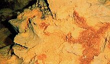
The Papahānaumokuākea Marine National Monument (PMNM) (roughly /pɑːpɑːˈhɑːnaʊmoʊkuˌɑːkeɪ.ə/) is a World Heritage listed U.S. National Monument encompassing 583,000 square miles (1,510,000 km2) of ocean waters, including ten islands and atolls of the Northwestern Hawaiian Islands. It was created in June 2006 with 140,000 square miles (360,000 km2) and expanded in August 2016 by moving its border to the limit of the exclusive economic zone, making it one of the world's largest protected areas. It is internationally known for its cultural and natural values as follows: (Full article...) Selected Picture -'Ōlelo (Language) -This section is here to highlight some of the most common words of the Hawaiian Language, ʻŌlelo, that are used in everyday conversation amongst locals.
Hou
New, fresh, again, more State Facts
State Symbols:
Selected article -The Northwestern Hawaiian Islands or Leeward Hawaiian Islands are a series of islands and atolls in the Hawaiian island chain located northwest of the islands of Kauai and Niʻihau. Politically, they are all part of Honolulu County in the U.S. state of Hawaii, except Midway Atoll, which is a territory distinct from the State of Hawaii, and grouped as one of the United States Minor Outlying Islands. The United States Census Bureau defines this area, except Midway, as Census Tract 114.98 of Honolulu County. Its total land area is 3.1075 square miles (8.048 km2). All the islands except Nihoa are north of the Tropic of Cancer, making them the only islands in Hawaii that lie outside the tropics. The Northwestern or Leeward Hawaiian Islands include:
Did you know? -
Hawaii News
Wikinews Hawaii portal
Quotes - "Ua mau ke ea o ka ʻāina i ka pono." — King Kamehameha III (Later became the Hawaiʻi State Motto.) On this day...May 20
Related portalsTopicsCategoriesAssociated WikimediaThe following Wikimedia Foundation sister projects provide more on this subject:
SourcesDiscover Wikipedia using portals |


